← Home · Investigation

Standard Penetration Testing (SPT) in Galway – Reliable Subsurface Data

Together, we solve the challenges of tomorrow.

LEARN MORE →

Galway's expansion from a medieval trading port to a modern city has pushed development onto the complex glacial deposits lining the River Corrib. The Drumlin landscape and raised marine sediments under areas like Knocknacarra and Doughiska demand a precise understanding of subsurface conditions before breaking ground. A Standard Penetration Test remains the most cost-effective way to verify bearing capacity and identify loose zones in these heterogeneous soils. Our technical team executes SPT campaigns across the city, providing the N-value data that structural engineers need to size foundations correctly. For deeper profiling in cohesive tills, we often pair the SPT with a CPT test to obtain continuous tip resistance and sleeve friction, giving a complete picture of the stratigraphy. With rainfall averaging over 1,100 mm annually, groundwater influence on SPT results is a factor we routinely account for in our Corrib-side investigations.

An energy-calibrated SPT hammer gives you a foundation number you can take to the bank—uncorrected data is just a rough guess.

Process and scope

A recent project on a sloping site near Salthill required SPT borings to 15 metres for a mixed-use apartment block. The upper 4 metres were loose, silty sands overlying a stiff Boulder Clay—a classic Galway profile. Our crew used an automatic trip hammer with energy calibration to ensure each blow count reflected the true resistance of the deposit. This matters because uncorrected N-values in gravelly lenses can mislead a designer into overestimating capacity. We apply overburden, rod length, and hammer energy corrections following the procedures in I.S. EN ISO 22476-3:2005, delivering a design-ready report. On sites where the clay fraction is dominant, we recommend a complementary Atterberg limits analysis to determine the plasticity characteristics and confirm the soil classification derived from the SPT sampler recovery.
Standard Penetration Testing (SPT) in Galway – Reliable Subsurface Data
Technical reference image — Galway

Local ground factors

The rig we mobilise for Galway jobs is a compact track-mounted drill, essential for manoeuvring through the tight urban lanes of the Latin Quarter and accessing soft ground sites near the Claddagh Basin without causing excessive disturbance. A common risk in the city is encountering buried peat lenses or infilled stream channels that don't show up on historical maps. An SPT sampler can punch right through a thin peat seam, giving a dangerously high N-value that masks the compressible layer below. Our lead driller logs every inch of recovery and immediately flags any organic material. We also watch for rod binding in the stiff Boulder Clay—a problem that can artificially inflate blow counts if friction isn't managed. The SPT gives you a number; the interpretation gives you the truth. That's where local experience in Galway's glacial stratigraphy becomes non-negotiable.

Need a geotechnical assessment?

Reply within 24h.

Email: contact@geotechnical-engineering.co

Video overview

Technical data

ParameterTypical value
Test StandardI.S. EN ISO 22476-3:2005
Hammer TypeAutomatic trip hammer with energy calibration (Er)
Borehole Diameter100–150 mm (rotary wash or hollow stem auger)
SamplerStandard split spoon (50 mm O.D., 35 mm I.D.)
Depth RangeUp to 30 metres below ground level
Data OutputN60, N1(60), fines content correlation, relative density estimate
Sampling Interval1.5 m depth intervals or at stratum change

Complementary services

01

SPT Borehole Drilling & N-Value Profiling

Execution of standard penetration tests at 1.5 m intervals using an energy-calibrated automatic hammer. Includes split-spoon sampling, visual logging, and jar sample collection for laboratory index testing. Suitable for sites across Galway city, from Ballybane to Barna.

02

SPT Data Reduction & Foundation Analysis Report

Conversion of raw field N-values to corrected N1(60) values. We provide allowable bearing capacity estimates for shallow foundations and preliminary pile length recommendations, integrating the SPT profile with laboratory results for a complete geotechnical interpretation.

Reference standards

I.S. EN ISO 22476-3:2005 – Geotechnical investigation and testing. Field testing. Standard penetration test, Eurocode 7 (I.S. EN 1997-2:2007) – Ground investigation and testing, I.S. EN ISO 14688-1:2018 – Identification and classification of soil, UK Specification for Ground Investigation (ICE, 2nd Ed.) – often referenced for SPT execution in Ireland

Frequently asked questions

What is the typical cost of an SPT investigation in Galway?

For a single borehole with SPT testing at standard intervals, you are looking at a range of €440 to €600. The final figure depends on access conditions, total depth, and whether you need additional laboratory testing. We provide a fixed-price proposal after a site walk.

How long does it take to get the SPT report after drilling?

You will have the factual field data within 48 hours of completing the borehole. The full interpretive report with corrected N-values, bearing capacity recommendations, and pile design parameters typically takes five to seven working days.

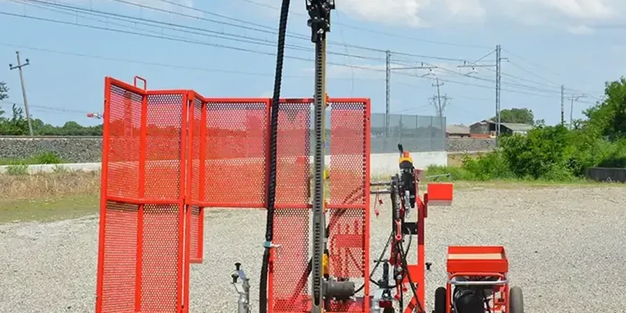
Can SPT testing be done on a small infill site in Galway city centre?

Yes. We use a compact, low-ground-pressure drill rig that can access tight back gardens and sites with restricted headroom. For areas with cobblestone or protected surfaces, we lay ground protection mats before bringing the equipment in.

What is the difference between N-value and N60?

The raw N-value is the number of blows the hammer records in the field. N60 is that number corrected to 60% of the theoretical free-fall hammer energy. Our rig uses an energy-calibrated automatic hammer, so we measure the actual energy transfer and apply the correction directly, removing a major source of uncertainty in your foundation design.

Location and service area

We serve projects in Galway and surrounding areas.

View larger map