Galway's expansion from a medieval trading port into a modern city of over 80,000 people has pushed development onto some of the most complex glacial and karst terrain in the west of Ireland. The River Corrib, which slices through the city center, sits atop a buried valley filled with soft alluvium and peat lenses, while the surrounding suburbs toward Barna and Oranmore encounter limestone bedrock riddled with dissolution features. For engineers working on these sites, invasive drilling alone rarely tells the full story. Electrical resistivity / VES (Vertical Electrical Sounding) provides a continuous subsurface profile that maps the boundaries between fill, peat, clay, and competent rock without disturbing the ground. When combined with targeted test pits to ground-truth anomalies, this geophysical method reduces the risk of encountering unmarked dissolution hollows or buried services that could delay a project by weeks. The Galway City Development Plan 2023-2029 explicitly encourages site-specific ground investigations in areas of suspected karst, making a resistivity survey not just prudent but often a planning requirement.
A single VES sounding in karst limestone can map the transition from weathered overburden to competent bedrock across 50 vertical meters without a single borehole.
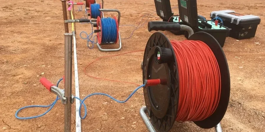
Process and scope
Fieldwork in Galway follows the framework of I.S. EN 1997-2:2007 (Eurocode 7 – Ground investigation and testing), which recognizes electrical resistivity as a valid indirect method for stratigraphic profiling and cavity detection. Our VES surveys use a Schlumberger array with current electrode spacings expanding from 1.5 m to 200 m, achieving effective investigation depths between 0.5 m and 60 m depending on ground conditions. The city presents two distinct resistivity signatures: the saturated alluvial clays along the Corrib estuary typically yield values below 30 Ωm, while the Carboniferous limestone bedrock of the Burren-like outcrops near Salthill can exceed 1,000 Ωm when dry and massive. This contrast is precisely what makes the method so effective here. A sudden drop in apparent resistivity at depth, for example, often indicates a clay-filled fissure or a water-bearing cavity that standard borehole spacing might miss. Every sounding is interpreted using 1D inversion software and calibrated against local borehole logs from the Geological Survey of Ireland's public database, ensuring the final geoelectrical model reflects the true lithology beneath Galway's streets.
Local ground factors
The contrast between Galway's East Side and the Salthill promontory illustrates why subsurface risk varies dramatically across short distances. In the Ballybrit and Parkmore industrial areas, widespread limestone bedrock lies beneath less than 3 m of glacial till; here, dissolution features are common and a pad foundation can punch through a thin rock bridge into a hidden cavity if the layout isn't informed by a resistivity profile. Move west to Salthill, and the picture changes: thick sequences of interbedded sand, gravel, and shell-rich deposits overlie the rock at depths exceeding 20 m, creating a high water table that complicates any excavation. A VES survey run along the proposed footprint of a warehouse or apartment block reveals these transitions in a single afternoon. Without it, a contractor might design for rock on one corner of the site and encounter running sand on the other. The City Council's Building Control section increasingly requests geophysical evidence alongside traditional borehole data for Category 3 structures, particularly in the flood zones mapped along the Corrib and Terryland River corridors.
Reference standards
I.S. EN 1997-2:2007 (Eurocode 7 – Ground investigation and testing), NSAI I.S. EN 1998-1:2005 (Eurocode 8 – Seismic design, relevant for site classification), Geological Survey of Ireland (GSI) Karst Data and Borehole Database, ASTM D6431-18 (Standard Guide for Using the Direct Current Resistivity Method), Galway City Development Plan 2023-2029 (Chapter 11: Natural Heritage and Flood Risk)
Frequently asked questions
What is the typical cost of an electrical resistivity / VES survey in Galway?
A standard VES investigation with 6 to 8 soundings, covering a typical residential or small commercial site in Galway city or suburbs, generally falls between €630 and €980. The final figure depends on site access, the depth of investigation required (which dictates maximum electrode spread), and whether we need to integrate the data with existing borehole logs from the GSI database. A detailed quotation is always provided after a desktop review of the site geology.
How deep can a VES sounding penetrate in the limestone around Galway?
With a maximum current electrode spacing (AB/2) of 200 m, we routinely reach effective investigation depths of 50 to 60 m in the Carboniferous limestone that underlies most of Galway. The actual penetration depends on the resistivity contrast: dry, massive limestone allows deeper current penetration, while saturated clay-filled fissures attenuate the signal and limit depth. For most foundation designs, 30 m is sufficient to confirm bedrock competency.
How does electrical resistivity complement a standard site investigation with boreholes?
Boreholes provide a direct, point-specific log of the ground, but the geology between boreholes is always an interpolation. A VES survey fills those gaps by producing a continuous geoelectrical profile that reveals lateral changes in lithology: a clay-filled dissolution pipe between two clean rock boreholes, or a wedge of peat that pinches out unexpectedly. The combined dataset reduces the risk of mischaracterizing the ground model and meets the 'adequate investigation' standard expected under I.S. EN 1997-2.
Can you run resistivity lines on paved surfaces in Galway city center?
Yes, but with some limitations. On asphalt or concrete, we use a combination of small-diameter electrodes drilled through the pavement and saline-saturated contact pads to reduce contact resistance. The noisy electrical environment in a city center, with its buried utilities and stray currents, requires longer stacking times during acquisition. For critical urban projects, we often schedule work during early morning hours to minimize cultural noise and obtain cleaner apparent resistivity readings.