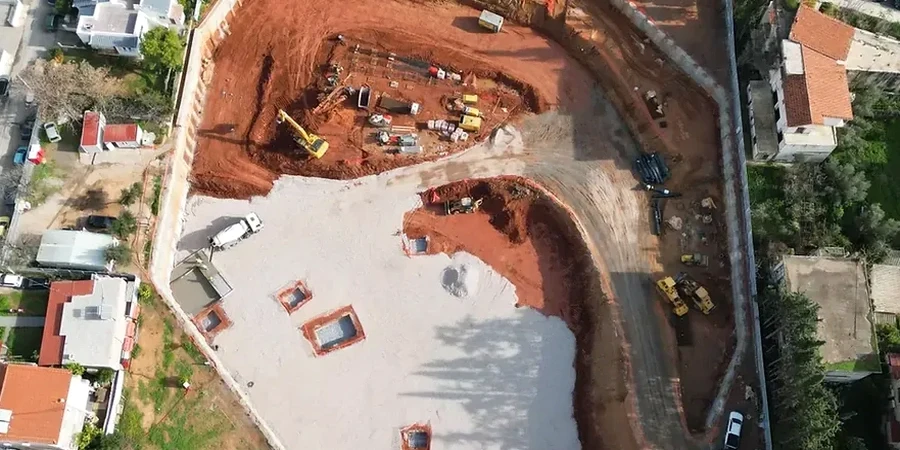
Galway’s subsurface is dominated by glacial till overlying limestone bedrock, a legacy of the last Ice Age that left the city sitting on dense, stony clay with erratic boulders. The Corrib River and its estuary add a layer of complexity: groundwater levels can rise to within 1.5 metres of the surface in the city centre, turning any excavation deeper than 3 metres into a dewatering challenge. Designing a deep excavation here without accounting for the transition from till to karstified limestone is a direct path to instability. We approach each project by first mapping the till matrix—its cohesion and boulder frequency—and then modelling the groundwater flow paths that make Galway’s geology unpredictable. For schemes near the docks or along the river corridor, integrating data from a CPT test provides a continuous profile of the soft alluvial lenses that often go undetected in borehole logs.
In Galway’s glacial till, the difference between a stable cut and a collapse often comes down to how you model a single water-bearing fissure.
Frequently asked questions
What is the typical cost range for geotechnical design of a deep excavation in Galway?
The design fee depends on excavation depth and complexity. For a typical basement or infrastructure cut in Galway, the engineering design work ranges from €1,730 for a straightforward single-level excavation to around €7,960 for a multi-level structure with complex groundwater control and adjacent building protection.
Which retaining system works best in Galway’s glacial till?
Diaphragm walls and secant pile walls perform well because they can be socketed into the limestone to cut off groundwater flow at the till-rock interface. Sheet piles are effective at shallower depths but may encounter refusal on boulders.
How do you handle the risk of hitting karst features during excavation?
We include a karst risk register in the Ground Investigation Report, using probe drilling ahead of the excavation face. The design includes contingency measures for grouting solution channels if they are encountered.
What software do you use for deep excavation analysis?
We use Plaxis 2D/3D for finite element modelling and WALLAP for limit equilibrium analysis of embedded walls. Both are calibrated with site-specific lab data from triaxial and oedometer tests.
Is the observational method acceptable for deep excavations under Eurocode 7?
Yes. We design the monitoring plan and define trigger limits for deformation and groundwater levels. If monitoring data stays within limits, the design is validated; if not, contingency measures are implemented immediately.